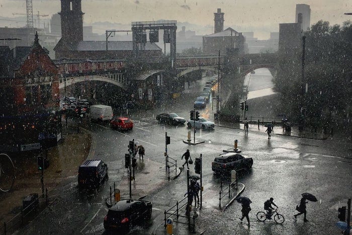
Storm Agnes set to batter Manchester tomorrow
- Written by Thom Bamford
- Last updated 1 year ago
- Uncategorized

Photo Credit: Not Quite Light
Hold onto your hats, Greater Manchester!
Storm Agnes is heading our way.
While the current cloudy conditions may not seem too ominous, we’re in for a weather rollercoaster ride.
Read on to discover how this impending storm will sweep across our region, bringing strong winds, heavy rains, and potential disruptions.
A yellow weather warning will be in effect starting at 12 p.m. tomorrow.
Current Weather Conditions
As of this Tuesday morning, our region is experiencing mostly cloudy skies.
However, sunny intervals are expected later in the day.
According to the Met Office, today’s temperatures will reach around 19°C, ensuring dry weather throughout.
Storm Agnes Approaches
Prepare for a significant shift in weather conditions.
Starting around 11 a.m. tomorrow, Storm Agnes is set to bring rainy and windy weather to Greater Manchester and various parts of the UK.
A yellow weather warning for wind will cover our region from noon and will continue until 7 a.m. on Thursday.
Impacts of Storm Agnes
Meteorologists are predicting strong winds, potentially reaching speeds of up to 80mph in certain areas.
These winds could lead to significant disruptions, including potential injuries, hazards to life, structural damage, and power outages.
Travel Disruptions Expected
Anticipate travel disruptions across roadways, railways, air travel, and ferry services due to the prevailing strong winds.
In Greater Manchester, rainfall is expected from around 11 a.m., intensifying into heavy showers during the afternoon.
Rainfall will persist into the early evening, accompanied by wind gusts of up to 40mph. The weather is predicted to settle overnight into Thursday morning.
Storm Agnes’ Path
Storm Agnes is expected to move through western regions of the UK and Ireland on Wednesday.
Coastal areas along the Irish Sea are likely to experience the most intense winds, though strong winds will impact the entire UK.
What the Met Office Says
Met Office chief meteorologist Steve Ramsdale has provided insights, stating: “While the exact trajectory and depth of Storm Agnes are still being finalised, there is a strong likelihood of wind gusts in the range of 50 to 60mph in some inland areas.
Exposed coastal regions may witness gusts ranging from 65 to 75mph, with a slight possibility of some locations experiencing winds of up to 80mph.
In addition to these potent winds, Storm Agnes will usher in substantial rainfall, with the heaviest accumulations likely in Scotland, northern England, Wales, and Northern Ireland.
A few high-altitude regions in Scotland could receive approximately 60mm of rainfall.
- This article was last updated 1 year ago.
- It was first published on 26 September 2023 and is subject to be updated from time to time. Please refresh or return to see the latest version.
Did we miss something? Let us know: [email protected]
Want to be the first to receive all the latest news stories, what’s on and events from the heart of Manchester? Sign up here.
Manchester is a successful city, but many people suffer. I Love Manchester helps raise awareness and funds to help improve the lives and prospects of people across Greater Manchester – and we can’t do it without your help. So please support us with what you can so we can continue to spread the love. Thank you in advance!
An email you’ll love. Subscribe to our newsletter to get the latest news stories delivered direct to your inbox.
Got a story worth sharing?
What’s the story? We are all ears when it comes to positive news and inspiring stories. You can send story ideas to [email protected]
While we can’t guarantee to publish everything, we will always consider any enquiry or idea that promotes:
- Independent new openings
- Human interest
- Not-for-profit organisations
- Community Interest Companies (CiCs) and projects
- Charities and charitable initiatives
- Affordability and offers saving people over 20%
For anything else, don’t hesitate to get in touch with us about advertorials (from £350+VAT) and advertising opportunities: [email protected]

How The Salutation became a cornerstone of Manchester’s story

Ukrainian artist studying in Manchester shares inspiring message about living life to the full


How Manchester’s turbulent past shaped a global icon of journalism


